


AgriSat app for iPhone and iPad
Developer: IDR-UCLM
First release : 06 Jul 2016
App size: 19.39 Mb
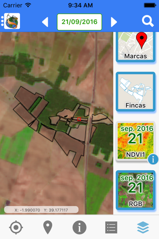
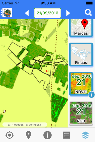
It enables crops monitoring throughout their growth cycle in a simple and intuitive way for improving crop management. The state of the crop, photosynthetic activity and variability within the plot is displayed. For that, dense time series of images of the main Earth observation satellites from NASA and the European Space Agency are used, approaching in many cases the frequency of one image per week.
The application displays by default the last image available and facilitates navigation on the time series of images, to follow the evolution of the green vegetation cover. This global and temporal information supports the decision making in a more accurate and precise way, allowing:
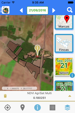
Detect and locate incipient anomalies in the growth and development of the crop, caused by natural events, accidents or operational errors; estimate the weekly needs of water and nutrients, know the evolution of the variability inside the plots and predict performance along with their spatial distribution.
The application includes GPS positioning on the displayed images, as well as georeferenced markers enabling to document incidents in points of interest to the user.
This system based on SPIDERwebGIS application is available for Smartphone and Tablet. It has been developed by the Institute of Regional Development of the University of Castilla-La Mancha (IDR-UCLM) in the frame of FATIMA project and in collaboration with AgriSat. To use it you need to register in the service offered by AgriSat Iberia SL.